Unity-AR GPS Location U3770
Create Location-Based Augmented-Reality experiences in Unity!
Programmable Render Pipeline (SRP) compatibility
The Unity Programmable Render Pipeline (SRP) is a feature that allows you to control rendering through C# scripts. SRP is the underlying technology that supports the Universal Rendering Pipeline (URP) and the High Definition Rendering Pipeline (HDRP).
Unity version
Built-in rendering pipeline
Universal Rendering Pipeline (URP)
High Definition Rendering Pipeline (HDRP)
2021.3.24f1
compatible
compatible
Not compatible
describe
Unity AR+GPS Location
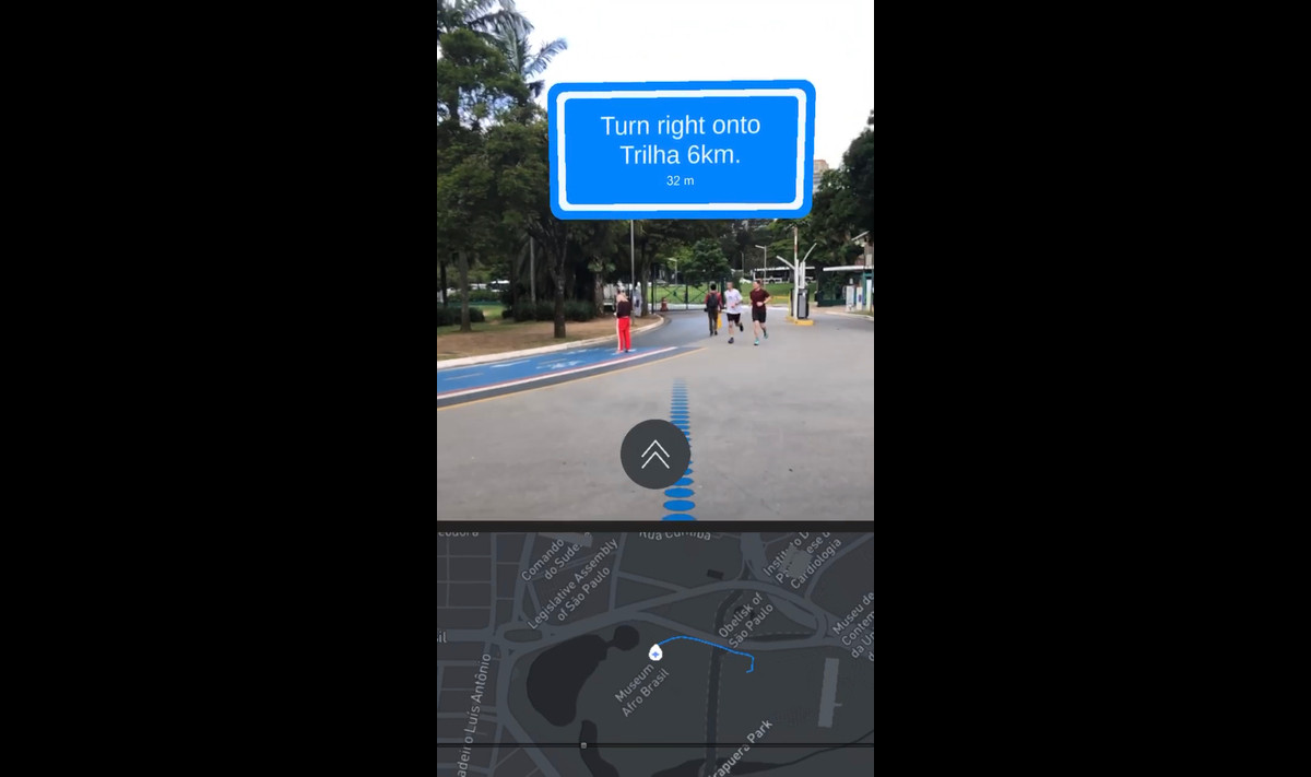
The ‘AR+GPS Location’ asset leverages Unity and augmented reality technology to determine the real-world geographic location of 3D objects using GPS coordinates.
Combine GPS data and AR tracking technology with Vuforia’s AR AR Foundation
achieve this.
Click here to view all documentation for this resource.
Click here to download the Totem Capture demo. In the demo, you can choose locations on the map to place 3D Totems, and get close to them to activate them.
–The main function–
*Position a 3D object at a geographic location determined by its latitude, longitude, and elevation.
*AR Hotspot is activated when the user is near a given location.
*Place 3D Text Maker at real-world locations of interest (Examples using OpenStreetmap included.)
* Device position and heading updates move smoothly.
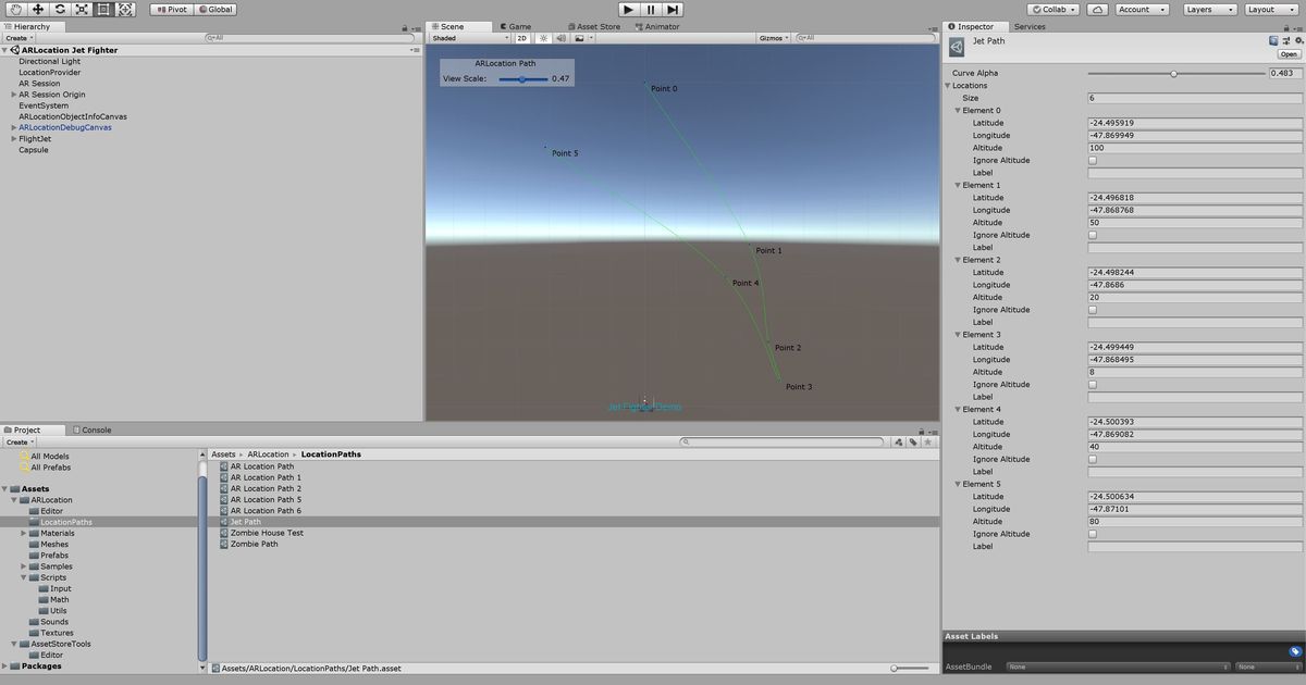
*Move or place objects along paths (Catmull-rom splines) on the map.
*Augmented reality ground shadows.
*Universal Catmull-rom curves and splines.
–Minimum requirements–
*For AR Foundation, an ARKit-enabled iOS device or an ARCore-enabled Android device is required (click here for a list of AR Core devices).
*For Vuforia, a device that supports ground identification is required (click here for a list of devices)
*Device must have functioning magnetic and GPS sensors.
*For better performance, we also recommend using a functioning gyroscope.
–Limitations–
*Altitude information is often imprecise, so it is currently best to use altitude relative to the device location or detected ground level.
*Landscape mode does not work properly on Android devices due to issues with tilt compensation of magnetic sensor data.
*Limitations due to GPS accuracy issues. Therefore, in good conditions, the accuracy is between 2 and 5 meters, while in poor conditions, the accuracy can reach 10 to 20 meters.
*Does not function properly indoors.
–Contact information–
For bug reports and issues, please follow this link.
For further assistance, please contact me at daniel.mbfm@gmail.com.
Copyright © 2018-2019 Daniel Fortes.
related keywords
GPS
AR
Location-based
Android
arcore
iOS
ARKit
Augmented Reality
location
native